Home
About Us
Our Services
Agriculture
Aerial Mapping & Survey
Infrastructure
Geospatial Support
3D Virtual Tour
Training
Our Products
Satellite Images
Geo-Plantation
Geospatial Portal
LiDAR
Gallery
Career
Blog
Contact
Home
About Us
Our Services
Agriculture
Aerial Mapping & Survey
Infrastructure
Geospatial Support
3D Virtual Tour
Training
Our Products
Satellite Images
Geo-Plantation
Geospatial Portal
LiDAR
Gallery
Career
Blog
Contact
Search
Search
Home
About Us
Our Services
Agriculture
Aerial Mapping & Survey
Infrastructure
Geospatial Support
3D Virtual Tour
Training
Our Products
Satellite Images
Geo-Plantation
Geospatial Portal
LiDAR
Gallery
Career
Blog
Contact
Home
About Us
Our Services
Agriculture
Aerial Mapping & Survey
Infrastructure
Geospatial Support
3D Virtual Tour
Training
Our Products
Satellite Images
Geo-Plantation
Geospatial Portal
LiDAR
Gallery
Career
Blog
Contact
Search
Our Services
Contact Us
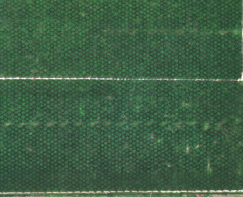
Agriculture
Discover full-featured drone technologies to assist agriculture and plantations in running more efficiently.
More Info
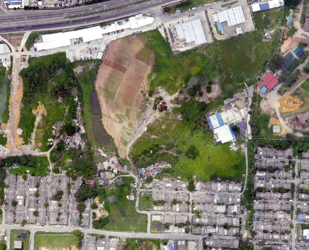
Aerial Mapping & Survey
We deliver results faster, empowering our clients to make more agile decisions with high-end surveying drones and a team of expert surveyors.
More Info
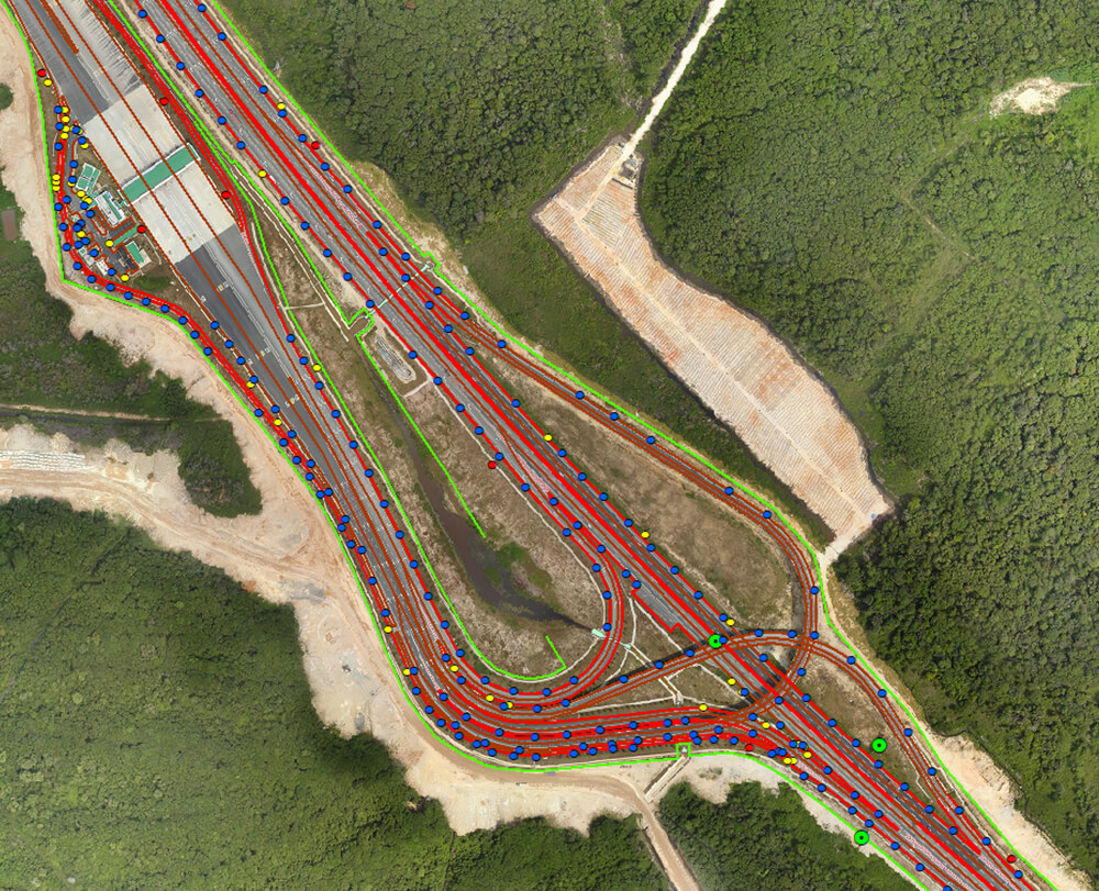
Infrastructure
Learn how drones can help with heavy infrastructure inspections and maintenance.
More Info
Geospatial Support
MySpatial also develops local, regional, national, and global geospatial layers from the ground up.
More Info
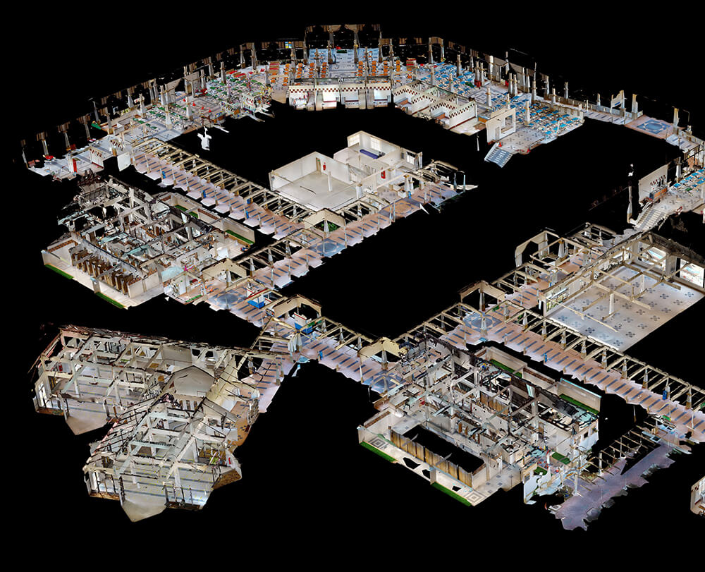
3D Virtual Tour
We deliver everything you need to digitise your space and manage it all online in one place, including industry-specific add-ons and extensions.
More Info
Training
Whether you're just getting started in GIS or want to expand your existing Geospatial skills, MySpatial provides a GIS training option to help you accomplish your goals.
More Info
Contact Us