Products - Satelite Images
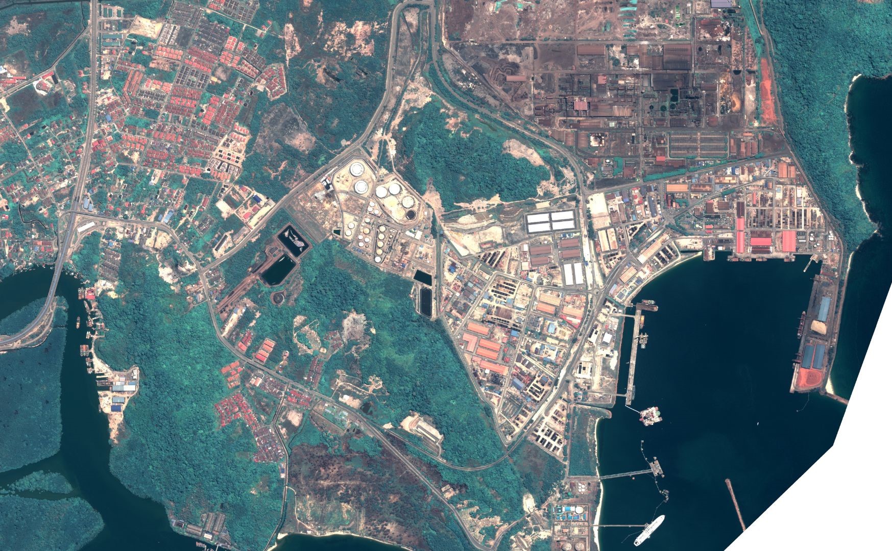
Unlocking Intelligence from Satellite Images
MySpatial provides low, medium and high-resolution satellite imaging datasets for almost every area on the planet. Work with one of our specialists to obtain a comparison of all accessible images from each commercial satellite imagery provider, including date, price, and resolution. We will work swiftly and effectively with you to ensure you receive the proper imagery for your project, whether it’s tasking or archive satellite imagery based on your Area of Interest (AOI).
Purchase Satellite Imagery
Our satellite imagery is grouped into 3 categories;
High-Resolution Imagery
- Provides the most advanced detail and is valuable in modelling, engineering, infrastructure, telecommunications, precision agriculture, disaster management and other applications.
Medium-Resolution Imagery
- It is notably useful in agriculture, forestry, and environment to get a good image of change over a broader area satellite map.
Low-Resolution Imagery
- It serves as a foundation for new projects and is useful in media and publication, regional research, and tracking broad patterns.
The following are several satellite images provided by MySpatial:
- Superview Constellation, SV1-1,2,3,4/SV2, 50 cm resolution, 8-Bands (Optical)
- EarthScanner, JL-1KF01/JL-1KF01B, 50 cm resolution, panchromatic (Optical)
- GaoFen-7, 65 cm resolution, panchromatic (Optical)
- ZY Hyperspectral, 2.5 m/10 m/30m resolution, 166 Bands (Optical- Hyperspectral)
- GaoFen-3 SAR, 1m resolution, C-Band SAR (Radar)1m GSD
- WorldView-1, 50 cm resolution, panchromatic (Optical)
- WorldView-2, 50 cm resolution, 8-Bands (Optical)
- WorldView-3, 30 cm resolution, 29-Bands (Optical)
- Pleiades-1, 50 cm resolution, 5-Bands (Optical)
- Pleiades-Neo, 30 cm resolution, 6-Bands (Optical)
- SkySat Planet, 72 cm resolution, 5-Bands (Optical)
- GeoEye-1, 50 cm resolution, 5-Bands (Optical)
- QuickBird, 60 cm resolution, 5-Bands (Optical)
- RapidEye, 5 meter resolution, 5-Bands – Red Edge (Optical)
- COSMO-SkyMed, 1 meter resolution, 1-Bands (Radar)
Additional Satellite Imagery Services
MySpatial offers clients the newest generation of satellite imagery and value-added geospatial products. While delivering this highly complex data and supporting technical materials, MySpatial can also provide the following imagery services:
- Mosaicking Services
- Image Enhancement Services
- Classification Services - Land Use/Land Cover
- Orthophoto Rectification
- Image Stereo Processing
- Feature Extraction – Vector Data Generation
- Image Analysis
- 3D Visualization