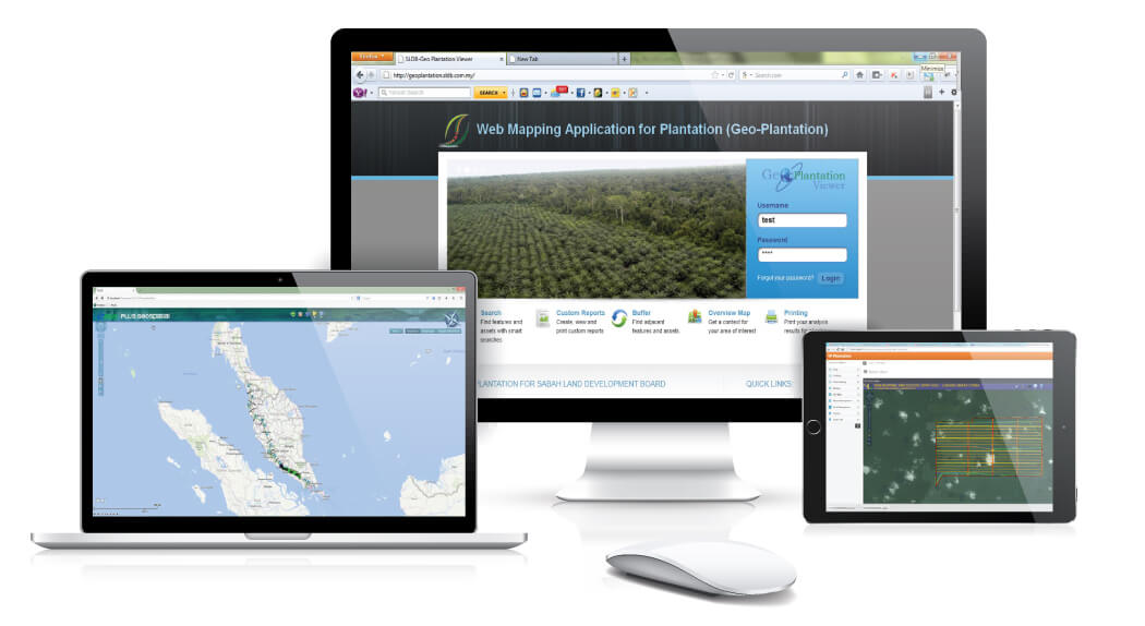
The Web Mapping Application for Oil Palm Plantation (Geo-Plantation) developed by MySpatial is a secure, full of content and tool-rich cloud-based mapping application that enables plantation managers to display and analyze information relevant to their plantation. Built on ESRI-based software, the platform’s open architecture includes basic and advanced tools and features that enable plantation manager to use a standard Web browser to:
- Identify plantation locations and related data such as administrative boundary (block), soil type, yield data, roads, precipitation, topography data, fertilizer data etc.
- Generate location-specific reports, such as a summary of the location’s key geographic features, performance of each block based on yield, the use of fertilizer and pesticide for a plantation based on block and real-time data (e.g., weather conditions, agro-climate).
- To retrieve, analyse and display plantation and ancillary data, based on time and location. Location may be defined interactively and graphically on screen or by selection of predefined lists based on administrative or management areas. Time duration will be defined by a starting and ending dates or predefined common time periods e.g. months or years.