logo-myspatial

Agriculture

Discover full-featured drone technologies to assist agriculture and plantations in running more efficiently.

Planning & Design of Plantation for Replanting and New Planting of Oil Palm

The ‘blueprint’ for new planting and replanting of oil palm plantations can be produced using UAV or satellite images, Digital Terrain Model (DTM), and ground survey. Our design and planning solutions can properly provide spatial information for phase, block, main road, sub road, drainage, nursery, and terrace. Explore more about geospatial services company in Malaysia.

Why Replanting are Important for Your Plantation?

Replanting is a very important aspect of oil palm cultivation because its provide the opportunity to correct past mistakes in layout, drainage and planting density, it also enables the use of the latest generation of planting materials together with the improved agronomic techniques. Through our solutions:

The planters can estimate the budget or expenses for new planting or replanting as seedlings, fertilizers, terraced, agricultural roads length, drainage and other plantation needs.

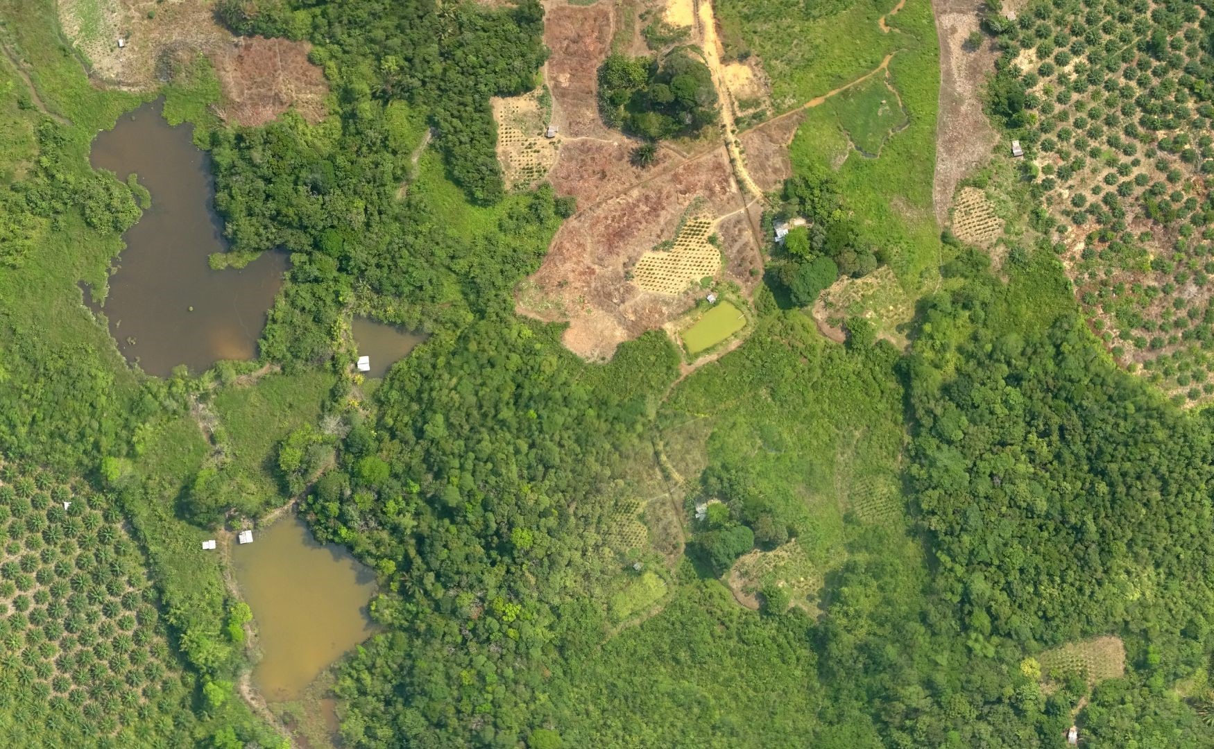
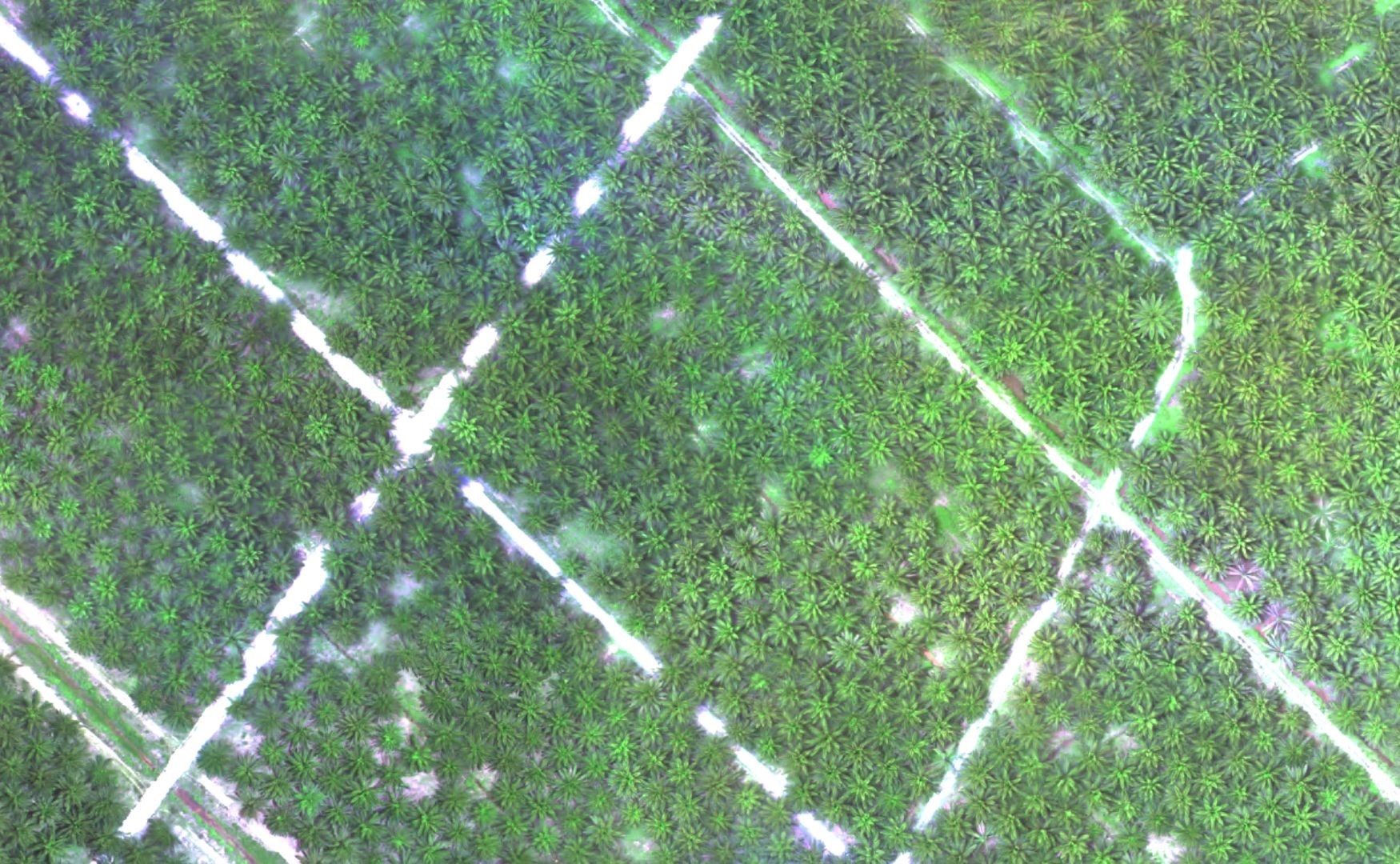
Plantation planning and design can help the planters to visualize topographic of the plantation area, determine the potential planting area, slope estimation, accurate estimation of plantation perimeters

Planned agriculture road system for better harvesting and evacuation

Complied with Roundtable on Sustainable Palm Oil (RSPO) or Malaysian Sustainable Palm Oil (MSPO) certification requirement

Plantation Inventory

The mapping exercise on plantation inventory using Unmanned Aerial Vehicle (UAV) or satellite images. It provides accurate information on tree count, palm density, plantation boundary and block boundary, road density. The information together with other data could be used for analysis fertilizer requirement and application, and more accurate yield projection, etc. Contact us for geospatial mapping service now.

The scope of mapping exercise for plantation inventory comprises; of plantation boundary, block boundary, tree counting/planting density, plantable areas/ unplantable areas, water bodies, river/ streams, road network, permanent Infrastructure, water catchments, temporary occupied areas, over planted outside boundary, over planted on other party land, over planted on reserved land, unplanted on disputed land, gross planted area, total block land area and total yield/ yield per ha.

There are several benefits using UAV services for oil palm application :

Crop Health Analysis

COMPLETE AGRICULTURAL UAV SOLUTION

MySpatial provides completely integrated agricultural UAV solutions that include everything that you need to begin using a UAV to identify problems early, increase yields, and profits.

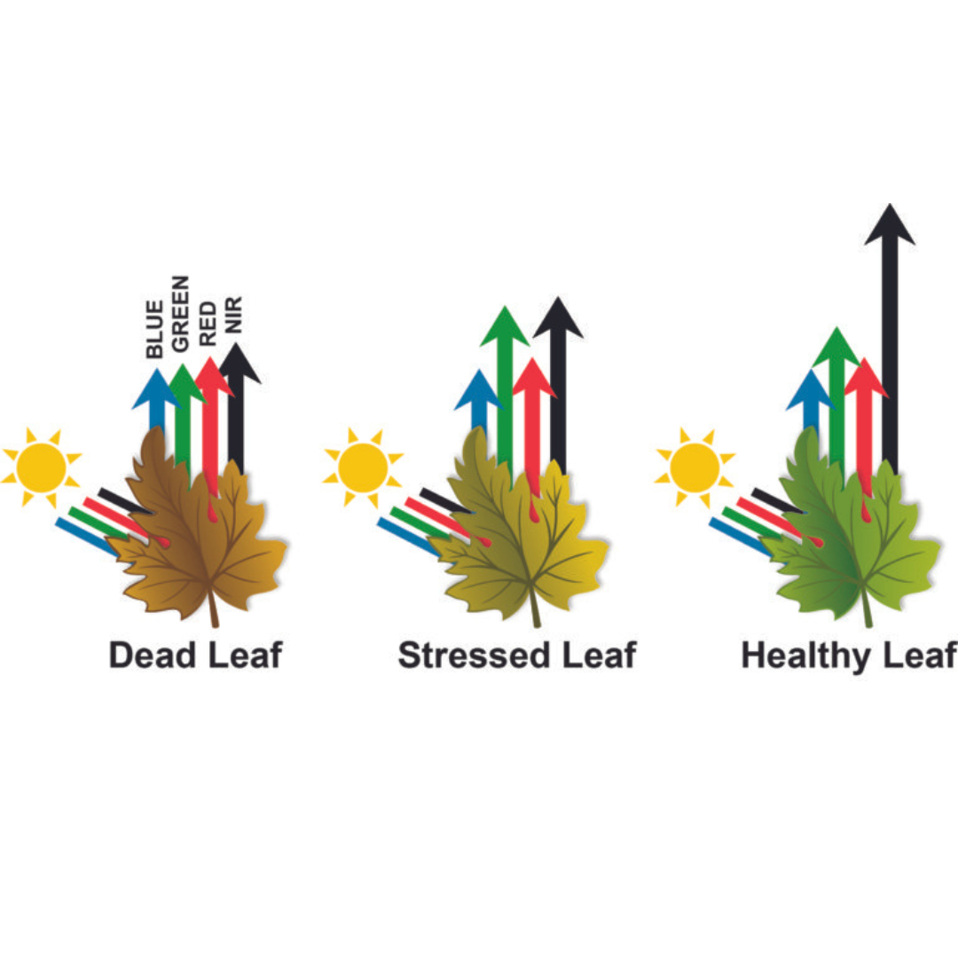
THE BEST SENSOR FOR PRECISION AGRICULTURE

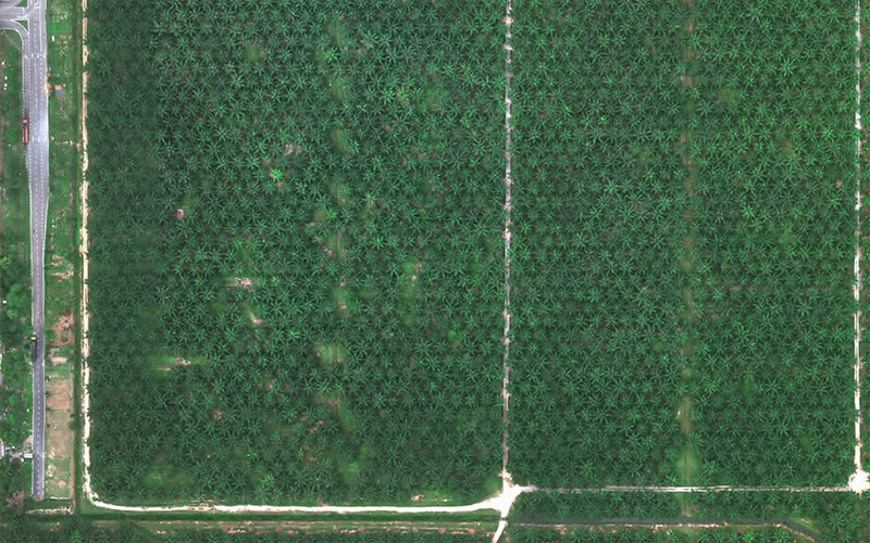
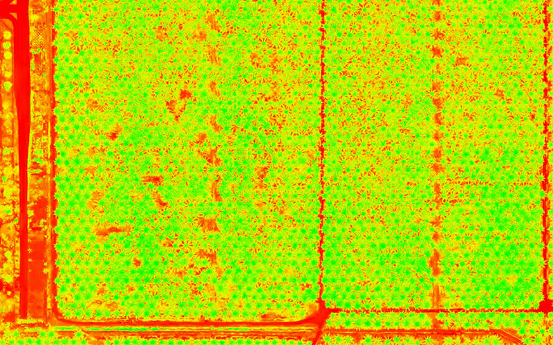
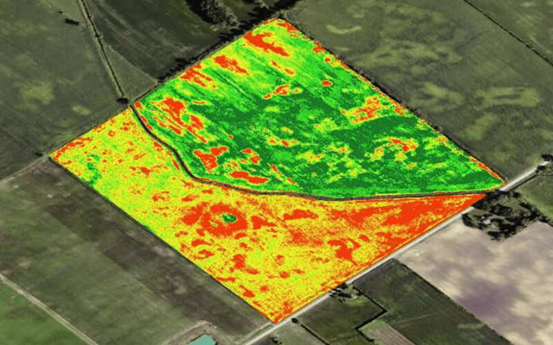
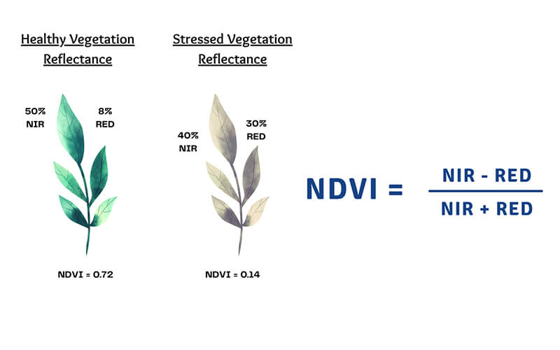
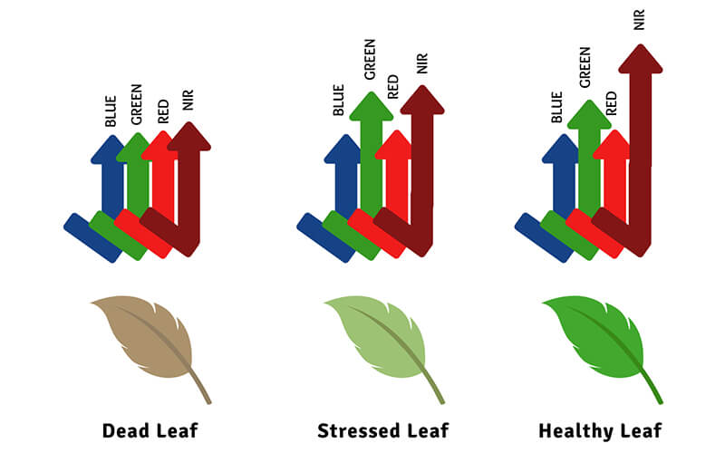
Our Multispectral sensor; RGB (Red/Green/Blue), NIR (Near-Infrared) and RE (Re-Edge) offers an efficient and effective way to survey small to large scale plantation operations to scale plantation operations to assess overall crop health.

REDUCE INPUT EXPENSES

Cost effective solution for crop health, efficiently apply inputs where you need and save money.

MINIMIZE LOSSES TO MAXIMIZE YIELDS

Our services put industry-changing algorithms into the hands of planters so they can maximize yield and minimize losses.

Benefits

A normal, healthy plant will absorb visible blue and red light and reflect green visible light, which is why they appear green to our eyes. In addition to green visible light, plants also reflect Near-Infrared (NIR) as this type of light isn’t actively used for the photosynthesis process. When a plant is weak or diseased, reflection of this NIR light is greatly decreased. Since red light is still being absorbed the same as a healthy plant, a mathematical algorithm can calculate the difference in what is being reflected across a field of crops. Once calibrated and processed, it will become clear which plants are thriving and which are struggling.

Index Maps (NDVI and SAVI) + Digital Surface Model + Orthomosaics all from one flight, using multispectral sensors and the RGB camera. Based on variety of data, we will help you to make better decisions with actionable data.

Drone Spray

Flexible, Accurate, Cost-Effective Agricultural Drone Spraying Services

Spraying drones are powerful tools that MySpatial can assist farmers or planters to speed up and automate manual agricultural processes. Spraying drones are being used for the application of:

Fertilizers

Herbicides

Pesticides

Fungicides

Seeds, and more.

Combined with insights produced by tools like Plantation Inventory and Crop Health Analysis, spraying drones can be utilised to target specific areas where treatment of fertiliser is necessary, reducing disease, increasing efficiency, work smarter, faster, and with greater precision than ever. The combination of speed and power means that areas are able to be treated up to 40 times faster than manual spraying operations.

Drone Spraying Benefits

Faster Application

Drone Spraying proven to be faster than traditional spraying methods

Flexibility and Reliability

Our Drone Spraying equipment features intelligent insight to ensure precision application for every farm

Precise and Accurate

With various nozzles suited for various applications, propellers accelerate the spray increasing reach

Save Time and Cost Effective

Drone Spraying can cover large area in less time and reducing labour cost