Geospatial Support Service
Outsource Geospatial Services to MySpatial
MySpatial is a established provider of Geospatial services, specialized software applications, and cost-effective spatial data management solutions that address real-world problems. MySpatial delivers a realistic approach to the issues posed by the scale, complexity, and diversity of spatial datasets thanks to our long-standing experience in the collecting and processing of spatial data.
Geospatial Services We Offer
Data Acquisition and Field Survey
- Aerial mapping and survey using Drone / UAVs
- Satellite remote sensing and monitoring
- Airborne LiDAR survey and mapping
- Drone LiDAR survey and mapping
- Drone Multispectral survey and mapping
- Terrestrial surveying, geodesy and advanced GNSS processing
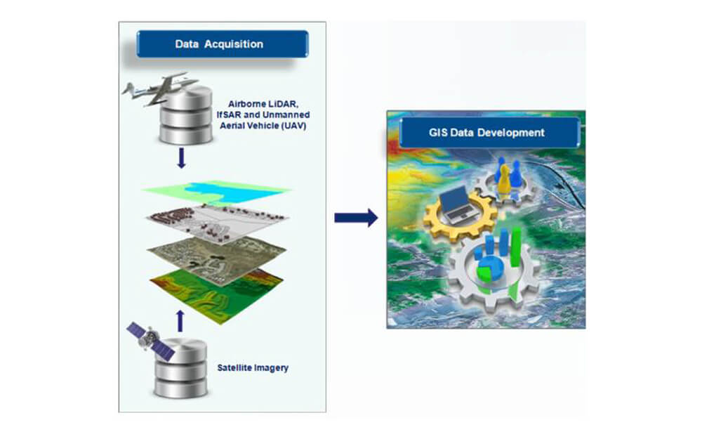
Geospatial Data Development
- Topographic Mapping
- Planimetric Mapping
- Utility Mapping
- Asset Inventory Mapping
- Vegetation Mapping
3D Visualisation
- 360 Aerial Panoramic - Outdoor
- 3D Virtual Tour - Indoor
- 3D Oblique
System Development and Customisation
- GeoPlantation
- Geospatial Portal
- MILINAV
- Business Intelligence
- Artificial Intelligence (AI)
- Internet of Things (IoT)
- Cloud-based data management solutions
Building Information Modelling (BIM)
A robust and accurate GIS data can be a powerful aid in making critical decisions, saving time and money, and even saving lives. MySpatial processes GIS data from any format, as well as from text files and paper maps, into optimized GIS data accessible through GIS desktop applications and internet map services consumed by mobile and desktop applications.
MySpatial also develops local, regional, national, and global geospatial layers from the ground up. We have extensive knowledge in sourcing, building and maintaining geospatial datasets. Whether your data of choice is Shapefile, MapInfo Tab, AutoCAD DWG, ESRI SDE, ESRI File Geodatabase, PostgreSQL or other spatial data, MySpatial can design and develop your GIS database to meet your needs.
The following are the sectors where MySpatial is strongly positioned to deliver its services:
- Agriculture – Oil Palm, Rubber and Paddy
- Transportation – Road and Highway Operator
- Local Authority and Municipalities (PBT)
- Infrastructure
- Defence
- Real Estate
- Forestry
- Utilities – Electricity, Water and Gas

The planters can estimate the budget or expenses for new planting or replanting as seedlings, fertilizers, terraced, agricultural roads length, drainage and other plantation needs.

Plantation planning and design can help the planters to visualize topographic of the plantation area, determine the potential planting area, slope estimation, accurate estimation of plantation perimeters

Planned agriculture road system for better harvesting and evacuation

Complied with Roundtable on Sustainable Palm Oil (RSPO) or Malaysian Sustainable Palm Oil (MSPO) certification requirement
